How Is a Wildfire Risk Score Calculated? Explained
Curious how is a wildfire risk score calculated? Learn what factors matter, how your score is determined, and what you can do to lower your wildfire risk.
When you're buying a home in a beautiful, wildland area, you check the foundation, the roof, and the plumbing. But are you checking its wildfire risk score? This single number is becoming as critical as a home inspection, as it can determine your ability to get affordable homeowners insurance—or any insurance at all. A high score can signal future costs and safety concerns that aren't visible during a simple walkthrough. Before you make an offer, it's vital to understand how is a wildfire risk score calculated and what a specific property's score means for your financial future and safety. This guide will walk you through what goes into a risk score, helping you evaluate properties with a clear-eyed view of the real risks involved.
Key Takeaways
- Your score blends regional risk with property-specific details: It analyzes factors you can't change, like local topography, alongside the critical details you can control, such as your home's building materials and the defensible space around it.
- This number has real financial consequences: Insurance companies use risk scores to determine your premiums and even your eligibility for coverage, directly affecting your ability to protect your home as an investment.
- Improving your score is achievable through targeted action: Focus your efforts on creating defensible space and hardening your home against embers to make the most significant impact on your safety and insurability.
What is a Wildfire Risk Score?
Think of a wildfire risk score as a credit score for your property's fire safety. It’s a single number that summarizes how likely your home is to be affected by a wildfire. This score isn't just an arbitrary grade; it's a data-driven assessment used by insurance companies, fire departments, and homeowners to understand and quantify risk. For you, as a property owner in a fire-prone area, this number is becoming increasingly important. It can influence everything from your insurance premiums to your peace of mind when the weather turns hot and dry.
Understanding your score is the first step toward protecting your home. A high score might feel alarming, but it also gives you a clear roadmap of what to work on. By learning what factors contribute to your score, you can take targeted, effective steps to reduce your risk and improve your home’s defensibility. A lower score doesn't just make your property safer—it can also make it more insurable and resilient for the long term. In this section, we’ll break down what goes into your score, how it impacts your insurance, clear up some common myths, and look at the powerful data that makes it all possible.
What Makes Up Your Risk Score?
There isn’t one single, universal formula for calculating a wildfire risk score. Different insurance carriers and risk assessment companies use their own models, which is why your score might vary depending on who provides it. However, they all analyze a similar set of core factors. These models use everything from satellite imagery and AI simulations to historical fire records to get a complete picture of the landscape.
The main ingredients include the environment around you, like the type and density of vegetation (fuel sources) and the steepness of your property (topography). They also factor in regional climate patterns and, most importantly, the specific features of your property. This includes your home’s building materials and the amount of defensible space you’ve created around it.
How Your Score Affects Homeowners Insurance
Your wildfire risk score has a direct impact on your wallet. Insurance companies rely heavily on these scores to determine their own risk in covering your property. A lower score generally signals to insurers that your home is a safer bet, which can lead to more favorable premiums and broader coverage options. On the other hand, a high-risk score often translates to higher insurance costs.
In many high-risk areas, a high score can make it difficult to find coverage at all. Insurers may choose not to renew existing policies or may deny new applications for homes they deem too risky. This is why actively working to lower your risk score isn't just about safety—it's a critical step in maintaining your home's insurability.
Common Myths About Wildfire Risk Scores
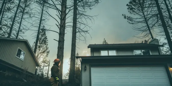
Let's clear up a few common misconceptions about wildfire risk. One of the biggest is thinking, "My home isn't in the forest, so I'm not at risk." The reality is that most homes destroyed by wildfires aren't burned by the main wall of fire but by wind-blown embers that can travel a mile or more ahead of it. These small, glowing embers can land in gutters, on decks, or in vegetation right next to your house, igniting a new fire.
Another myth is assuming your insurance policy is a safety net that will automatically cover a total rebuild. While policies are designed to help you recover, a high-risk score could lead to non-renewal before a fire ever happens, leaving you uninsured. Proactively managing your property's risk is the only way to ensure you're protected. You can learn more by debunking wildfire myths with trusted sources.
The Role of Data in Your Score
Your wildfire risk score isn't just a guess; it's built on a massive foundation of scientific data. Much of this information comes from government agencies like the U.S. Department of Agriculture's Forest Service, which provides comprehensive data on vegetation, weather patterns, and fire history across the country.
Sophisticated computer models then use this data to run thousands of simulations of potential fire seasons. These simulations help analysts understand risk by predicting how a fire might behave in a specific area, considering factors like wind, terrain, and available fuel. This data-driven approach is what makes your score a powerful and reliable tool for assessing the real-world threat to your property.
How is a Wildfire Risk Score Calculated?
Think of a wildfire risk score as a comprehensive report card for your property's safety. It’s not just one number pulled out of thin air; it’s the result of a complex analysis that looks at your home, your land, and the wider environment. Different organizations, from insurance companies to government agencies, have their own methods for calculating this score, but they all aim to answer the same fundamental question: How likely is a property to be damaged by a wildfire?
To do this, they combine massive datasets and sophisticated computer models. These models process information on everything from the type of trees in your yard to the steepness of your driveway and the historical weather patterns in your region. The final score gives you a snapshot of your current risk level, helping you understand where your vulnerabilities are and, most importantly, what you can do to protect your home. It’s a powerful tool for turning anxiety into action.
The Math Behind the Models
First things first: there isn't one single, universal formula for calculating a wildfire risk score. Different companies use different models, which is why you might see your score presented on a scale of 1-10, 1-100, or as a simple low-to-extreme rating. The key takeaway is that a higher number or a more severe rating always indicates a higher risk.
These models are built using advanced tools like AI simulations, satellite imagery, and historical fire data to predict how a fire might behave in your specific area. They run thousands of scenarios to see how different factors could influence a fire's spread and intensity. The goal is to create a detailed, data-driven picture of the potential threat to your property.
Analyzing Vegetation and Fuel Sources
A huge piece of the risk puzzle is what’s growing around your home. In the world of wildfire, plants, trees, and even dead leaves are considered "fuel." The models analyze the type, amount, and condition of this fuel on and around your property. A home surrounded by dense, dry brush is at a much higher risk than one with a well-maintained, irrigated lawn.
This analysis looks at everything from the species of trees in your yard (some are more flammable than others) to the overall density of the surrounding forest. Using data from satellite photos and property records, risk assessors can get a clear picture of the fuel load near your home, which directly impacts how intense a fire could be if it reaches your property.
Factoring in Topography and Weather Patterns
Where your home is situated matters just as much as what’s around it. Topography—the physical shape of the land—plays a critical role in how fire spreads. Wildfires tend to move much faster uphill, so a home located on a steep slope is considered higher risk. The models also account for features like canyons, which can act like funnels for wind and heat, accelerating a fire’s speed and intensity.
Weather is the other major environmental factor. Risk models incorporate decades of climate data, looking at typical wind patterns, humidity levels, and temperature trends for your area. By running thousands of simulations that vary these conditions, fire behavior modeling can predict the likelihood of a fire starting and spreading during a typical fire season.
Looking at Your Property's Specific Features
While regional factors are important, your home's ability to survive a wildfire often comes down to its immediate surroundings. This critical area, often called the Home Ignition Zone, is the space right around your house that needs the most attention. The risk calculation takes a close look at the materials your home is made of—is your roof fire-resistant? Do you have vulnerable wooden siding or single-pane windows?
It also assesses the landscaping closest to your foundation. Are there flammable shrubs planted right next to the house? Is there a pile of firewood stacked against the wall? These property-specific details are heavily weighted in your score because they are some of the most critical factors in determining whether your home will ignite from embers or direct flames.
How Community Infrastructure Plays a Role
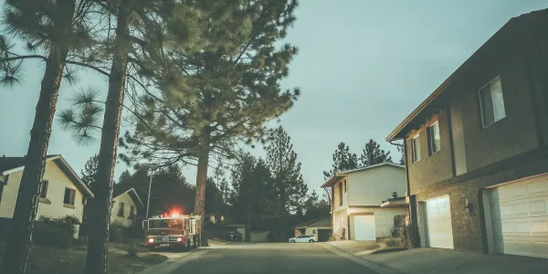
Finally, your individual risk score is influenced by the community you live in. The models consider factors like the accessibility of your neighborhood for emergency responders. Are the roads wide enough for a fire truck? Is there more than one way in and out? The availability of water sources like fire hydrants also plays a part.
Beyond emergency access, the overall risk profile of your town or county is considered. FEMA’s National Risk Index, for example, compares the wildfire likelihood of communities across the country. Living in a community that has proactive fire mitigation programs and building codes can positively influence your property’s risk assessment, as these collective efforts make the entire area safer.
Who Calculates Your Score and How?
Understanding your wildfire risk score can feel a bit like trying to figure out your credit score—you know it’s important, but it’s not always clear who is calculating it or what data they’re using. The first thing to know is that there isn’t one single, universal score. Instead, several different groups create their own risk assessments, each with a slightly different purpose and methodology. The main players you’ll encounter are insurance companies, government agencies, and specialized third-party data companies.
Each of these groups pulls from a massive pool of information to build their models. They look at everything from high-resolution satellite imagery and historical fire data to your property’s specific features, like the slope of your land and the types of plants in your yard. Because they all use slightly different formulas and weigh factors differently, your score can vary from one source to another. One insurer might see you as a moderate risk, while a local fire agency might flag your neighborhood as a higher-risk zone. The key is to understand who is creating the score you’re looking at and what it means for you.
Using Satellite and Remote Sensing Data
Much of the initial data used to calculate wildfire risk comes from a bird's-eye view. Companies and agencies use advanced technology like satellite imagery and remote sensing to analyze huge areas quickly and efficiently. This technology allows them to map out vegetation density, which acts as fuel for a fire, and identify the topography of the land, since fire behaves differently on steep slopes than it does on flat ground. By combining this imagery with historical fire records, climate predictions, and even AI-powered simulations, analysts can build a detailed picture of how a fire might behave in a specific region. This high-tech approach provides the foundational data layer that many risk models are built upon.
How Insurance Companies Calculate Risk
For insurance companies, a wildfire risk score is a critical tool for managing financial risk. They use these scores to determine whether they will offer a policy for a property and how much to charge for it. A home with a high-risk score will almost always face higher premiums, and in some cases, an insurer might decide not to offer coverage at all or may not renew an existing policy. Insurers often purchase risk data from third-party analytics companies or develop their own proprietary models. Their primary goal is to accurately price their insurance products to reflect the real-world risk, ensuring they can cover potential claims.
How Government Agencies Calculate Risk
Government agencies, on the other hand, calculate risk with a focus on public safety and resource management. Organizations like the U.S. Department of Agriculture's Forest Service provide data that powers tools like FEMA’s National Risk Index. This index helps communities understand their wildfire risk compared to other communities across the country. These government-level assessments aren't for setting insurance rates but for informing public policy, emergency planning, and the allocation of firefighting resources. They help fire departments and city planners identify which areas need the most attention, whether it’s through fuel reduction projects, public education campaigns, or updated building codes. Their goal is to protect entire communities, not just individual properties.
Using Third-Party Assessment Tools
Beyond insurers and the government, there’s a growing industry of third-party companies that specialize in wildfire risk assessment. These firms provide detailed risk scores and reports to a wide range of clients, including real estate developers, mortgage lenders, and individual homeowners. They often offer a more granular analysis than broader government models, sometimes looking at a property parcel by parcel. These specialized tools can be incredibly valuable if you’re buying a home in a high-risk area or if you want a more detailed understanding of your own property’s vulnerabilities. By getting an independent assessment, you can gain actionable insights that go beyond a simple score, helping you focus your efforts on the most effective risk-reduction measures.
Why Your Score Can Change Over Time
It’s important to remember that your wildfire risk score isn’t set in stone. It’s a dynamic number that can and will change. A prolonged drought can increase vegetation risk and raise your score, while a community-wide fuel reduction project could lower it. Most importantly, the actions you take on your own property, like creating defensible space, can have a direct and positive impact. Furthermore, since there’s no single standard, different companies use different scales—some might score from 1 to 10, while others use a 1 to 100 scale. This is why focusing on the underlying risk factors is more productive than getting hung up on a specific number.
A Closer Look at Your Score's Components
Your wildfire risk score isn’t just one single number pulled out of thin air. It’s a combination of several key factors that, when put together, create a detailed picture of your property’s unique situation. Think of it like a credit score, where different elements like payment history and credit usage combine to tell a story. Understanding these components is the first step toward taking control and improving your home’s safety. Each piece of the puzzle gives you clues about where you’re already strong and where you can make the biggest impact.
Assessing Wildfire Likelihood
This part of your score answers the question: "What are the chances of a wildfire happening in my area?" It’s not a guess; it’s the result of sophisticated fire behavior modeling. Experts run thousands of simulations that consider everything that contributes to a fire starting and spreading. These models analyze regional weather patterns, the shape of the land (topography), and common ignition sources based on decades of historical data. This gives a science-based probability of a wildfire occurring near your property, providing a foundational layer for your overall risk assessment.
Calculating Potential Intensity
If a wildfire does happen, how powerful would it be? That’s what potential intensity measures. It calculates the energy a fire is expected to release, which translates to how hot and fast it could burn. The two biggest factors here are topography and fuel. Steep slopes can cause fires to spread uphill rapidly, while dense forests or dry grasslands provide more fuel to burn. A home on a flat, sparsely vegetated lot will have a much lower potential intensity score than one on a steep, wooded hillside, simply because the conditions for a powerful fire are different.
Measuring Your Property's Exposure
Exposure is a straightforward but crucial component. It simply determines whether your property is located in a place where a wildfire could occur. If your home is within or near an area with any chance of burning, it’s considered exposed. This metric doesn't yet look at your home's construction or your defensible space efforts. It’s a geographic reality check that establishes whether your property is in a potential path of a wildfire. For most people in wildfire-prone regions, the answer here is yes, which is why the next components are so important.
Determining Your Home's Susceptibility
This is where you have the most control. Susceptibility measures how vulnerable your home is to damage if a wildfire reaches it. This analysis focuses on the immediate area around your house, often called the Home Ignition Zone. It looks at things like your home’s building materials (is your siding flammable?), the condition of your roof, and the landscaping choices you’ve made. A home with a well-maintained, non-combustible perimeter is far less susceptible to damage than one with overgrown shrubs right up against the walls.
Scoring Your Protection from Embers
Many people picture a huge wall of flames when they think of wildfire, but the biggest threat to homes often comes from something much smaller: embers. These tiny, burning particles can travel a mile or more ahead of the main fire, landing on or near your house. Your score evaluates how well your home is protected from this threat. It checks for vulnerabilities like uncovered vents, gutters clogged with dry leaves, or flammable items stored under a deck. Securing these weak points is one of the most effective actions you can take to protect your property.
How to Improve Your Wildfire Risk Score
Seeing a high wildfire risk score can feel overwhelming, but it’s not a final verdict. Think of it as a starting point—a guide showing you exactly where you can make meaningful improvements. Taking action to lower your score not only helps with insurance but, more importantly, significantly increases your property's chances of surviving a wildfire. The most effective strategies focus on two key areas: the space immediately surrounding your home (defensible space) and the materials and design of your house itself (home hardening).
By focusing on practical, proven methods, you can systematically reduce your property's vulnerability. These aren't just theoretical exercises; they are tangible steps that fire professionals recommend because they work. From simple landscaping changes to more involved structural upgrades, every action you take contributes to a safer home and a lower risk score. Let's walk through the most impactful ways you can take control and improve your property's resilience.
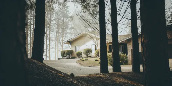
Create Defensible Space Zones
Defensible space is the buffer you create between your home and the surrounding vegetation. This space is crucial for slowing or stopping the spread of wildfire and protecting your house from direct flames and radiant heat. Experts recommend creating distinct zones around your property. The area immediately around your home, extending out 30 feet, is the most critical. Further out, landscaping should be managed to reduce a fire's intensity and keep it on the ground instead of in the treetops. Creating these defensible space zones gives firefighters a chance to safely defend your home.
Harden Your Home Against Wildfires
While defensible space manages the landscape, home hardening focuses on the structure itself. The goal is to make your house more resistant to catching fire from flying embers, which can travel a mile or more ahead of a wildfire. Key upgrades include installing a Class-A fire-rated roof, using multi-pane windows, and enclosing the eaves to prevent embers from getting trapped. It’s also vital to maintain at least six inches of clearance between the ground and the bottom of your siding. These home hardening techniques are some of the most effective measures you can take to protect your property, as they address the most common ways homes ignite during a wildfire.
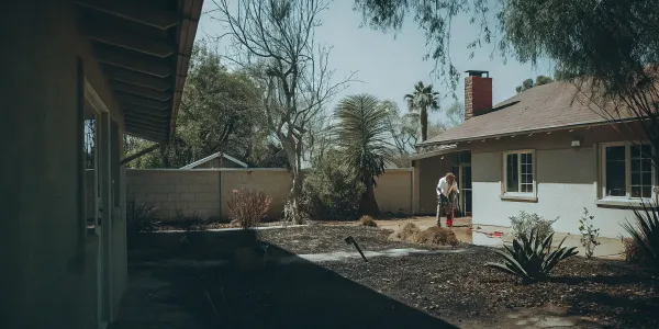
Implement Smart Landscaping Strategies
The plants you choose for your yard play a big role in your property's overall fire risk. Smart landscaping involves selecting and maintaining vegetation to reduce potential fuel sources. Homeowners should prioritize fire-resistant plants, which are typically species with high moisture content that are less likely to ignite. Avoid highly flammable plants like juniper, cypress, and pine, especially close to the house. Proper spacing between shrubs and trees is also essential to prevent fire from climbing from smaller plants into tree canopies. This doesn't mean you have to clear your entire yard—it's about making strategic choices that create a beautiful, fire-wise landscape.
Commit to Regular Maintenance
Creating a fire-safe property isn't a one-and-done project; it requires ongoing commitment. Regular maintenance is key to ensuring your defensible space and hardened home remain effective. Simple seasonal tasks make a huge difference. This includes cleaning leaves and pine needles from your roof and gutters, mowing dry grass and weeds, and pruning any tree branches that hang over your roof. Proper attention to these vulnerable, easily-ignited areas of the home helps to decrease the home’s risk of being destroyed by wildfire. Making these tasks a regular part of your home care routine is one of the easiest and most affordable ways to maintain a low risk score.
Get a Professional Risk Assessment
Understanding your specific vulnerabilities is the first step toward effective mitigation. A professional risk assessment gives you a detailed, data-driven evaluation of your property, moving beyond guesswork. These assessments analyze everything from your home's building materials to the surrounding vegetation and topography. Services like Defensible Space Score provide a clear report and an actionable list of recommendations tailored to your property. This allows you to prioritize your efforts and investments where they will have the most impact. For those looking to buy property in a high-risk area, getting a score beforehand can provide critical insight into potential insurance and safety challenges.
Related Articles
- Fire Safety Guidelines
- Wildfire Risk Score FAQ
- Defensible Space Score Overview
- Your Guide to the CAL FIRE Defensible Space Map
- Your Guide to the FireSmart Home Ignition Zone
Frequently Asked Questions
My neighbor and I live on the same street. Why is my wildfire risk score so different from theirs? It’s a great question that gets to the heart of how these scores work. While you share the same general location, your scores are calculated based on the specific details of your individual properties. Assessors look closely at things like your home’s building materials, the type of landscaping you have right up against the house, and your maintenance habits. Your neighbor might have a fire-resistant roof or have diligently cleared away flammable vegetation within five feet of their foundation, while you might have different features. These property-specific factors are weighed heavily and can create a significant difference in scores, even between homes that are right next door.
Is my score permanent, or can it change over time? Your wildfire risk score is definitely not permanent. Think of it as a living number that reflects current conditions. It can change for a few reasons. First, the actions you take matter most. When you create defensible space or upgrade your home with fire-resistant materials, your score can improve. On the other hand, external factors like a prolonged drought can increase the risk for the entire region, which might cause your score to go up. This is why regular maintenance and staying proactive are so important—they help you maintain a good score and adapt to changing conditions.
What's the most important first step I can take to improve my score? If you're feeling overwhelmed and want to know where to start, focus on the area immediately surrounding your home. Fire experts call this the Home Ignition Zone, and the most critical part is the first five feet from your foundation. Start by removing anything flammable in this zone. This includes clearing out dead leaves from under your deck, replacing wood mulch with gravel or stone, and moving firewood piles at least 30 feet away from the house. Securing this immediate perimeter is the single most effective action you can take to prevent embers from igniting your home.
If I improve my property, will my insurance company automatically lower my premium or renew my policy? While there's no universal guarantee, taking proactive steps to lower your risk gives you the best possible leverage with your insurance carrier. Insurers want to see that you are actively managing your property's risk. After you’ve completed mitigation work, be sure to document everything with photos and receipts. Share this information, along with any professional risk assessment reports, with your agent. It demonstrates that you are a responsible homeowner and can be a powerful tool in conversations about your premium or policy renewal.
My house isn't made of wood. Do I still need to worry about home hardening? Yes, absolutely. Many people think a stucco or brick home is immune to fire, but most homes are lost to wildfires because of embers, not a direct wall of flames. These small, burning embers can travel over a mile and find their way into small, vulnerable openings. Home hardening is about sealing those weak points. This includes covering attic vents with fine metal mesh, ensuring your windows are double-paned, and cleaning flammable debris from your gutters. Your home is only as strong as its most vulnerable point, regardless of what the walls are made of.